
Three Areas of Transformation
These are the three most common spatial conditions that will benefit from being transformed into a sponge landscape in the backwater area.


A. Agriculture lands, where only farmers are located nearby

B. Farming and small communities located in between natural features

C. Farmland that are near rivers and oxbows, or other water bodies
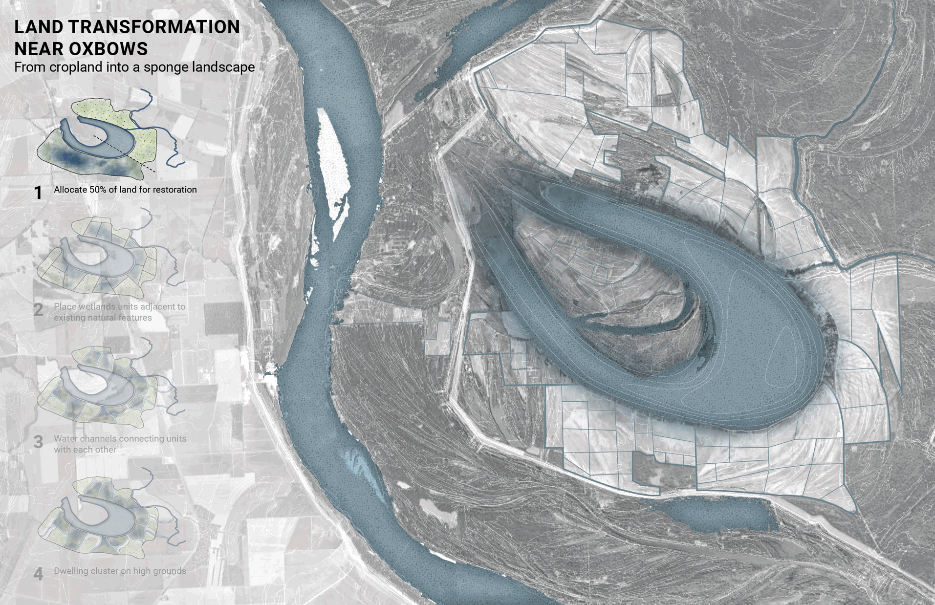
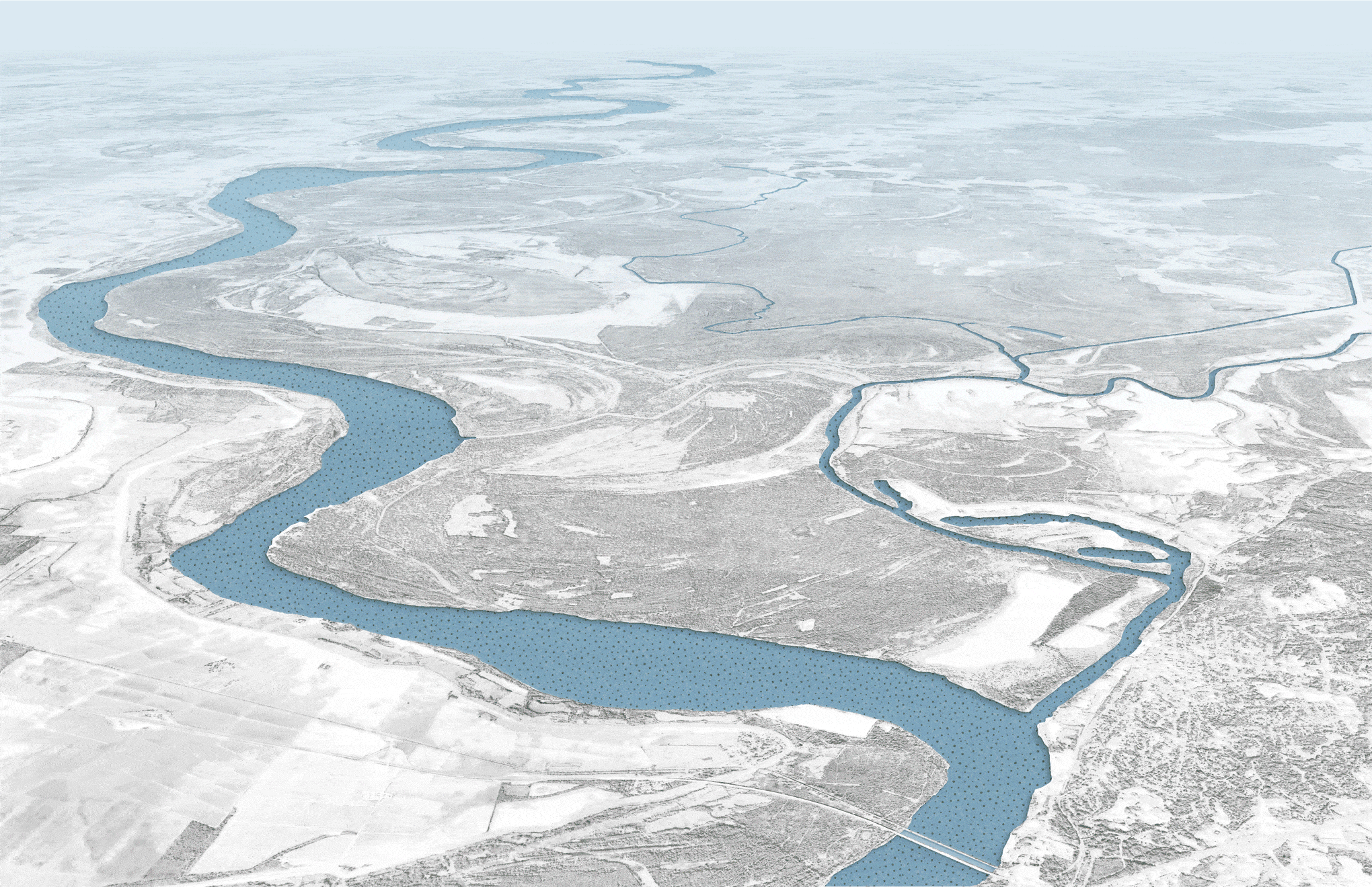
Land Transformation Near Oxbows
Envision for the land transformation from cropland into a sponge landscape, for example, by the Eagle Bend oxbow. During the high-water season, the wetlands work with the oxbow to absorb and retain the heavy rainfall, thus protecting the cropland and living areas.
Zooming into a smaller scale, this mosaic of wetlands increases the land’s capacity to absorb the significant projection of rainfall due to climate change. Re-introducing these wetlands will have multiple short and long-term benefits, including habitats for fish and wildlife, water filtration, and flood mitigation.


Linking Rural to Urban
The efforts of the Yazoo Sponge Alliance by creating a sponge landscape can help reduce backwater flooding, demolishing the need for the pump. In turn, the region becomes a destination for both wildlife and visitors for the ecological richness in the area.
The City of Vicksburg will apply the concept of a sponge system in an urban setting. Together, the rural and urban areas revive the sponge heritage of the land, bring in economic opportunities, and protect communities in the lower Mississippi from flooding.
Sponge Riverfront for Vicksburg
The resulting sponge landscape forms a connected holding system that revitalizes the natural ecosystem of the backwater area while fostering a form of farming that works in harmony with nature.

Vicksburg’s new riverfront will integrate with the surrounding wetland habitat. It connects to a network of water holding systems within the urban fabric, such as green roofs, bioswales, and rain gardens.

The waterfront provides crucial public spaces that the city currently lacks for the community to gather and engage with the batture riverfront, which is the alluvial lands between the River and the levee. The riverfront leads to trails that will surface during low water season. Slide the divider left and right to see both sides.


The skatepark near the riverfront becomes the go-to spot for all ages to pursue a hobby, socialize, or just to enjoy the sun.
The same space doubles as stormwater retention to keep the community safe from flooding.